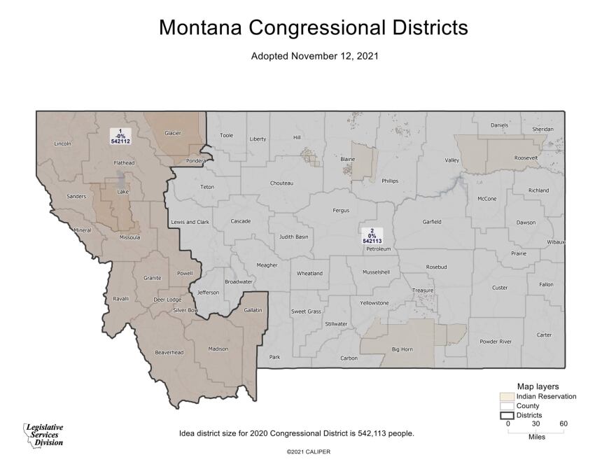
A final congressional map outlining the state's two U.S. House districts was submitted to the Montana Secretary of State’s office Friday. Montana’s redistricting commission reversed course on an earlier amendment.
The Montana Districting and Apportionment Commission made one final adjustment to the congressional map before sending it to the Secretary of State’s office.
The commission reversed an amendment from Democrats to split Pondera County along the Blackfeet Indian Reservation instead down the middle of the county. A Pondera County commissioner testified during their meeting and asked for the original middle split as it creates a more equal population distribution.
Republicans voted to rescind the change along with the commission's nonpartisan chair Maylinn Smith.
The commission also decided after much debate that the western district will be known as “District 1” and the eastern district will be known as “District 2.”
Copyright 2021 Montana Public Radio. To see more, visit Montana Public Radio.


